最新旅游调查问卷模板


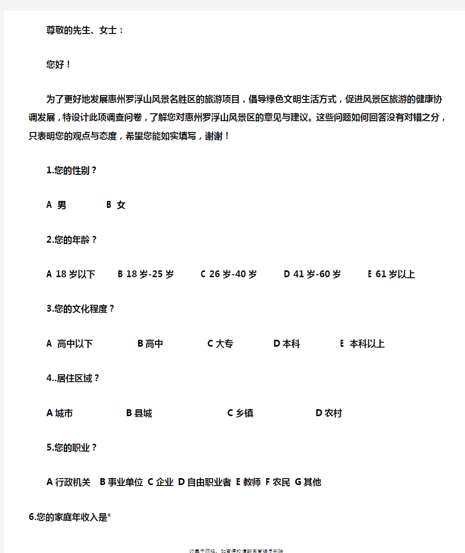
尊敬的先生、女士:
您好!
为了更好地发展惠州罗浮山风景名胜区的旅游项目,倡导绿色文明生活方式,促进风景区旅游的健康协调发展,特设计此项调查问卷,了解您对惠州罗浮山风景区的意见与建议。这些问题如何回答没有对错之分,只表明您的观点与态度,希望您能如实填写,谢谢!
1.您的性别?
A 男
B 女
2.您的年龄?
A 18岁以下
B 18岁-25岁
C 26岁-40岁
D 41岁-60岁
E 61岁以上
3.您的文化程度?
A 高中以下B高中C大专D本科
E 本科以上
4..居住区域?
A城市B县城C乡镇D农村
5.您的职业?
A行政机关B事业单位C企业D自由职业者E教师F农民G其他
6.您的家庭年收入是*
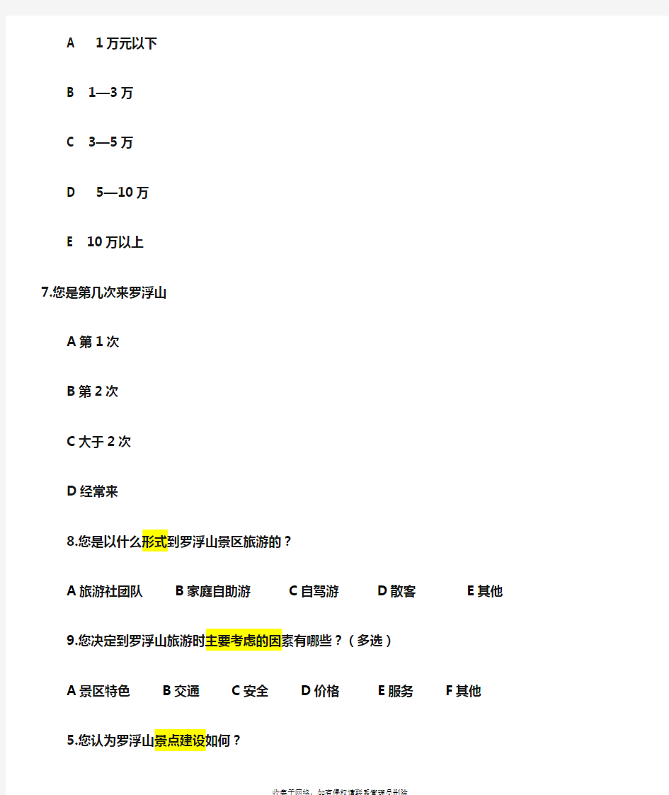
A 1万元以下
B 1—3万
C 3—5万
D 5—10万
E 10万以上
7.您是第几次来罗浮山
A第1次
B第2次
C大于2次
D经常来
8.您是以什么形式到罗浮山景区旅游的?
A旅游社团队B家庭自助游C自驾游D散客E其他
9.您决定到罗浮山旅游时主要考虑的因素有哪些?(多选)
A景区特色B交通C安全D价格E服务F 其他
5.您认为罗浮山景点建设如何?
A有特色B一般C 特色不强
10.请根据景点对您的吸引力从1到5排序(其中1为最具吸引力,2为较具吸引力,依次减弱)
A人文历史观光景点B休闲娱乐、度假型C特色节日、特色展出
D体育赛事、运动健身E生态养生
11.您对罗浮山景区的各种定价的评价(用5分制表示, 5分表示太贵了,4分表示有点贵,3分表示适中,2分表示便宜,1分表示太便宜)
门票价格 5 4 3 2 1
餐饮价格 5 4 3 2 1
旅游纪念品价格 5 4 3 2 1 12.您是从哪种渠道获得罗浮山景区的旅游资讯?
A旅行社或者旅游代理商□同学、同事、朋友等的介绍D旅游手册、宣传画
B电视、报纸、杂志的广告或报道与介绍E旅游博览会
C互联网的广告或报道与介绍F其他13.您到罗浮山旅游的主要目的是:
A休闲/度假B学习/体验C观光/购物D访亲/交友E亲近自然 F寻求刺激G其他
9.您在结束旅游后觉得您是否达到了主要目的:
A是B否
14.您对罗浮山旅游服务质量的总体评价(用5分制表示, 5分表示最好,4分表示很好,3分表示一般,2分表示不好,1分表示最差)景点 5 4 3 2 1
导游服务 5 4 3 2 1
餐饮 5 4 3 2 1
交通 5 4 3 2 1
娱乐 5 4 3 2 1
购物 5 4 3 2 1 15.您认为罗浮山工作人员的服务满意吗?
A很满意 B 比较满意 C 一般D比较不满意 E 很不满意如果您认为工作人员工作不佳(选择D或E),主要表现在:
A履行岗位职责不到位B服务态度冷淡C服务质量低D 素质低
16.您认为罗浮山景区内的各种标识如何?
A很好,标识很清楚,找景点很容易
B还行,标识清楚,基本能找到景点,但一些景点容易错过
C不太好,标识不清楚,很多景点容易错过
D很不方便,标识复杂,很不清楚
17.如果有机会,您下次还会来罗浮山游玩吗?
A会
B有可能,但会在有兴趣的地方多留一会
C不太可能,除非服务水平提高或增加景点
D再也不会来了
18.您认为罗浮山需改进的环节?
A旅游交通B住宿设施C景区设施D餐饮E接待服务质量F其他19.您认为xxx景区目前面临的主要问题是:
A开发不够
B基础设施落后
C监管力度差
D恶性竞争,相互削价
20..您此次在罗浮山逗留了多久?
A一天B半天 C 1小时
21.您这次旅游是和谁一起同行?
A家人B朋友C同学D同事E情侣F我喜欢独自旅游
22.您在景区的总消费(元/人)
A100以下 B 100-250 C 250-500 D 500以上
23.您对罗浮山风景名胜区的发展有哪些建议?
Summarizing The Global Positioning System
Abstract:Global Positioning System is based on the background of the United States Department of Defense.It is designed,invested,developed,and operated by the United States Department of Defense ,GPS is a satellite-based positioning and time transfering GPS positioning function has a wide range of applications in the modern measurement and a more modern building.GPS-RTK technology is also widely used in modernization building, and now GPS has also been shown to be an important civilian communities of interest, and increasingly wide range of applicated.
Keyword:GPS,Locating,RTK,Lay out,Survey
1.Background
The 50s, the former U.S.S.R has not launched humanities first artificial earth satellite, the American scientists in along its track research in, had discovered the Doppler shift phenomenon, and has facilitated Doppler satellite navigation posi- tioning system completing using this principle, has obtained the enormous success in the military and the civi aspect, was in a navigation localization history leap, our country once has also introduced many Doppler receiver, applied to the island association measured, the Earth explored and so on the applied to the island
association measured, the Earth explored and so on the domain. But because Doppler satellite orbit highly low, signal-carrier frequency low, the track precision enhances with difficulty, causes the pointing accuracy lowly, satisfies the geodetic survey or the project survey request, is more impossible to use in the astronomy Earth dynamics research. In order to enhance the satellite positioning the precision,US started from 1973 to prepare for construction global positioning system GPS (Global Positioning System).After has entered the plan proof, the system test stage,started in 1989 to launch the official work satellite,and completely completed in 1994, investment use. The GPS system spaceartially is composed by twenty one satellites, evenly distributes in six orbit, the ground level is 20,000 Kilometers, the inclination of orbit is 55, the flat heart rate approximately is 0, the week contract is 12 hours, the satellite to the earth launching two wave bands intelligence signals,the intelligence signal frequency respectively is 1575.442 mega cycles per second (the L2 wave band), on the satellite has installed the precision very
