新加坡陆路交通管理局综合交通战略规划
LAND TRANSPORT MASTERPLAN
This Land Transport Masterplan is the result of the exciting work we began in October 2006, when LTA undertook the Land Transport Review in consultation with the Ministry of Transport. The Review brought LTA’s Board members, management and staff together with members of the public, other government agencies and private stakeholders to discuss the many issues we face in our land transport policy. The focus group discussions, the online feedback on our Talk2LTA portal, the insights gained of those who played ‘The Great Transport Challenge 2020’ e-game and more have contributed to our Masterplan for the next 10 to 15 years, picking up where the 1996 White Paper on A World Class Land Transport System has brought us.
Since 1996, LTA has delivered on many of its goals. But the next 10 to 15 years will be more challenging: a growing population, expanding economy and the public’s higher expectations will test our mettle to make public transport predominant, manage congestion and meet the many needs of our people. These goals are achievable and are essential to the long-term, overall success of Singapore and our economy. The Masterplan maps the road ahead for our land transport system and prioritises the work for LTA. Delivering the desired outcomes by 2020 will not be easy, but LTA’s board members, management and staff are fully committed to make every resource available to making a people-centred land transport system a reality. MICHAEL LIM CHOO SAN
Chairman, Land Transport Authority
ARF Additional Registration Fee
ALS Area Licensing Scheme
AYE Ayer Rajah Expressway
BCR Bene?t Cost Ratio
BKE Bukit Timah Expressway
BRT Bus Rapid Transit
CBA Cost-Bene?t Analysis
CBD Central Business District
CCTV Closed Circuit Television
CNG Compressed Natural Gas
CO2Carbon Dioxide
COE Certi?cate of Entitlement
CPF Central Provident Fund
CTE Central Expressway
ECP East Coast Parkway
EMAS Expressway Monitoring Advisory System
ERL Eastern Region Line
ERP Electronic Road Pricing
EWL East-West Line
FDBL Full Day Bus Lane
GLIDE Green Link Determining System
GNSS Global Navigation Satellite System
GPS Global Positioning System
GPV Goods-cum-passenger Vehicle
GFA Gross Floor Area
GVR Green Vehicle Rebate
HDB Housing and Development Board
IMTI Integrated Multi-modal Travel Information System IRR Internal Rate of Return
ITS Intelligent Transport System
IU In-vehicle Unit
LRT Light Rapid Transit
LTA Land Transport Authority
J-Eyes Junction Electronic Eyes System
JIE Jurong Industrial Estate
KJE Kranji Expressway
KPE Kallang-Paya Lebar Expressway MCE Marina Coastal Expressway
MEWR Ministry of the Environment and Water Resources MOT Ministry of Transport
MRT Mass Rapid Transit
MTR MTR Corporation
NEA National Environment Agency
NETS Network for Electronic Transfers
NParks National Parks Board
NPV Net Present Value
NSCS National Safety Council of Singapore
NSE North-South Expressway
NSEW North-South and East-West Lines
NSL North-South Line
OMV Open Market Value
PCU Passenger Car Unit
PGS Parking Guidance System
PIE Pan-Island Expressway
POB Pedestrian Overhead Bridge
PPP Purchasing Power Parity
PTO Public Transport Operator
PTC Public Transport Council
QoS Quality of Service
RCPS Range-based Car Parking Standard
RTS Rapid Transit System
RZ Restricted Zone
SBST SBS Transit Ltd
SLE Seletar Expressway
SMRT SMRT Corporation Ltd
SPRING Standards, Productivity and Innovation Board SURS Singapore Underground Road System
TPE Tampines Expressway
TSL Thomson Line
UITP Union Internationale des Transports Publics (International Association of Public Transport) USEPA United States Environment Protection Agency VQS Vehicle Quota System
WHO World Health Organisation
WIS Workfare Income Supplement Scheme
ARF ALS AYE BCR BKE BRT CBA CBD CCTV CNG CO2 COE CPF CTE ECP EMAS ERL ERP EWL FDBL GLIDE GNSS GPS GPV GRA GVR HDB IMTI IRR ITS IU LRT LTA J-EYES JIE KJE KPE MCE MEWR MOT MRT MTR NEA NETS NPARKS NPV NSCS NSE NSEW NSL OMV PCU PGS PIE POB PPP PTO PTC QOS RCPS RTS RZ SBST SLE SMRT SPRING SURS TPE TSL UITP USEPA VQS WHO WIS ABBREVIATIONS
EXECUTIVE SUMMARY 1THE ROAD THUS FAR 234
5
THE WAY FORWARD MAKING PUBLIC TRANSPORT A CHOICE MODE
MANAGING ROAD USAGE MEETING THE DIVERSE NEEDS OF THE PEOPLE
6
CONCLUSION
page 2page 12page 18
page 24
page 82
page 68
page 48
ANNEX A: SUMMARY OF INITIATIVES
page 86
ANNEX B: KEY FINDINGS OF THE SINGAPORE
PUBLIC TRANSPORT INDUSTRY STRUCTURE REVIEW
page 91CONTENTS
The 1996 White Paper on A World Class Land Transport System has guided our land transport development over the past decade.
It has delivered a land transport system that has served Singaporeans well. However, our population has increased signi?cantly in the inter-vening years and become more diverse. Expectations have
also risen with growing af?uence.
By 2020, we expect that travel demand would increase from the current 8.9 million journeys a day to about 14.3 million journeys
a day. Given the land constraint of our small island state, the projected increase in travel demand must be met largely by public transport as it is the most space-ef?cient means of carrying large numbers of people.
However, the public transport mode share during the morning peak hours has declined from 67% in 1997 to 63% in 2004. The challenge is not just to reverse this declining trend but to raise it and to ensure that our public transport system can cater to the signi?cant increase in travel demand. We also need to re-examine our policies to better meet the needs of the greying population, the higher expectations of our people as well as the less privileged and lower income group.
It is therefore timely for us to review our current strategies in the light of the new challenges to meet our people’s needs and aspirations. A PEOPLE-CENTRED
LAND TRANSPORT SYSTEM
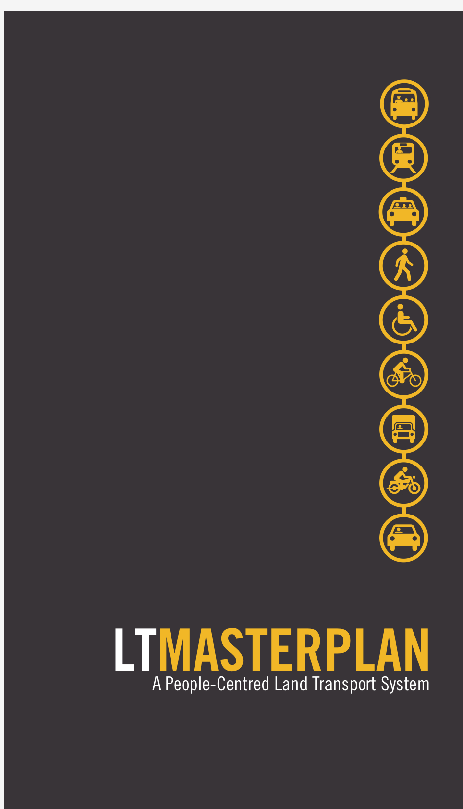
Our vision is to work towards a more people-centred land transport system that will meet the diverse needs of an inclusive, liveable and vibrant global city. We have identi?ed three key strategic thrusts that will shape our land transport policies and development for the next 10 to 15 years. They are:
? Making public transport a choice mode
? Managing road usage
? Meeting the diverse needs of the people MAKING PUBLIC TRANSPORT
A CHOICE MODE
Today, the public transport mode share stands at 63% during morning peak hours. We target to increase this to 70% by 2020.
To achieve this, we have to transform our public transport system
to make it more attractive to Singaporeans and competitive with the car. In particular, we must overcome the principal problems of long waiting times, long journey times and overcrowding by strength-ening the integration of our public transport system. Our buses
and rail network must be well integrated as a uni?ed system from the commuters’ perspective where transfers are seamless and convenient; services are easily accessible, reliable and comfort-able; journey time is competitive relative to cars; and fares remain affordable. Our public transport system must be attractive not
just to existing users, but also people who have access to cars
so that they will embrace the bus or train as “my other car”.
expanded and much denser rail network will extend the reach of the RTS to many more people and places. Within the Central Area, a commuter will be able to access a RTS station within ?ve minutes walk on average. Capacity on the existing lines will also be enhanced by increasing the frequency of trains. Commuters can look forward to better connectivity and a more comfortable ride on the trains. Greater contestability in the public transport industry To encourage greater ef?ciency and service improvements for the bene?t of commuters, we will introduce greater contestability in the RTS industry by issuing shorter operating licences for future RTS lines, compared to the 30-year licences today. The basic bus service market will also be gradually opened up to allow competition for the bus market i.e. competitive tendering for the right to operate a pack-age of bus services. Enhance travel experience and safety To provide pedestrians with a more comfortable and conducive walk-ing environment, more covered linkways and pedestrian overhead bridges will be provided. This will also improve the connectivity and accessibility of our public transport system for our commuters. We will also build more fully integrated transport hubs where bus interchanges and RTS stations are co-located with retail and com- mercial activities. Real time public transport travel information will be available through various mobile platforms to help commuters plan their journeys. Platform screen doors will also be installed at above-ground MRT stations to enhance the safety of commuters and minimise inconvenience caused by service disruptions. MANAGING ROAD USAGE We face increasing constraints in road building as Singapore becomes more densely built up. Our vehicle population now stands at 850,000 and continues to grow. Rising af?uence has also increased the propensity to drive. Between 1997 and 2004, our car population grew by 10% but the number of car trips increased by 23%. To keep traf?c ?owing smoothly on our roads, we have to adopt a holistic approach that includes road expansion as well as managing demand for road use by controlling vehicle growth and restraining usage. A more effective Electronic Road Pricing (ERP) system The ERP has served us well in maintaining smooth-?owing traf?c on our roads. More cities around the world are also beginning to embrace road pricing as an effective congestion management tool. Our ERP system has remained essentially unchanged since its introduction in 1998. A decade on, a larger vehicle population and a greater propensity for car use have resulted in more prevalent congestion on the roads. It is therefore critical that we review and enhance the effectiveness of the ERP to better address current and future traf?c conditions. The following changes to the ERP system will take effect progressively from July 2008:? Re?ne the method of measuring traf?c speeds. The 85th percentile speed measurement method will be used to By 2020, we aim for at least 85% of public transport commuters to complete their journey within 60 minutes during the morning peak hours, from the time they set out on their journey to their destination (i.e. ‘door-to-door’ journey time), up from 71% today. Average public transport journey times will be reduced from 1.7 times of that by car today to 1.5 times by 2020.
An integrated public transport system To enhance the integration and ef?ciency of public transport services, the Land Transport Authority (LTA) will take on the role of a central bus network planner by 2009. It will plan the public transport network from the commuters’ perspective, focusing on the ‘total journey’ experience of the commuters. LTA will enhance our hub-and-spoke system, so that our bus and rail services work in partnership. There will be more frequent and direct feeder bus services so that com-muters can reach the transfer hubs quickly, and enjoy seamless and ef?cient transfers to the Mass Rapid Transit (MRT) or trunk buses to continue with their journeys.To facilitate transfers, a distance-based through-fare structure will be adopted by 2009 so that commuters will be charged a fare based on the total distance travelled in a journey, without incurring a transfer penalty when they switch between buses or between the bus and MRT. This will encourage commuters to take the most ef?cient routes.By December 2008, an integrated season pass will be introduced to allow unlimited travel on our public transport services. This will provide convenience and value-for-money for frequent commuters.Overall, transfers will be seamless with no transfer fare penalty, and journey time on public transport will improve.
Buses will enjoy greater priority on the roads We will give greater priority to buses on the roads. Our target is to improve average bus speeds to 20 – 25kph by 2009, up from 16kph and 19kph for feeder and trunk buses respectively today. By June 2008, we will increase the network of bus lanes from 120km to 150km, and treble full day bus lanes (FDBL) from 7.6km to 23km. It will be mandatory for motorists to give way so that buses can come out of bus bays without delay, and buses will enjoy signal priority over other vehicles at major junctions in the city. With these measures, commuters can expect a speedier and smoother ride on the bus. The reliability of bus travel will also improve as buses enjoy greater right of way on the roads.
Expand the Rapid Transit System (RTS) network and capacity As we improve bus services and enhance their integration with the train services, we will expand signi?cantly the RTS network. By 2020, we will double the RTS network from 138km today to 278km. We will make major investments in new lines and exten-sions, namely, the Thomson Line (TSL), the Eastern Region Line (ERL), the Tuas Extension to East-West Line (EWL), and the North-South Line (NSL) Extension in the Marina Bay area. The vastly
determine whether ERP rate changes on an expressway or
road are necessary. With this change, at least 85% of motorists will generally be assured of smooth travel on ERP-priced roads, as opposed to using average speeds today where a signi?cant proportion of motorists may, on some routes, travel at speeds
below the optimal speed ranges.
? Increase the initial ERP charges and subsequent rate adjust-ment to make sure that the ERP rates remain effective in
in?uencing motorists’ behaviour.
? Set up ?ve new gantries along the Singapore River to manage congestion in the city area more effectively by cutting down
through traf?c between the commercial and shopping areas
of Bugis, Marina Centre, Bras Basah and Clarke Quay, and
the of?ce-based area of Shenton Way and Raf?es Place.
With the above changes, ERP coverage will be more extensive and ERP charges will be higher. Motorists who choose to drive on priced roads during the ERP operational hours will generally experience smoother and faster journeys.
We will continue to lower vehicle ownership taxes such as Additional Registration Fees (ARF) and road taxes, as we rely more on usage charges.
Lower vehicle population growth rate
As the road expansion programme slows down from the current 1% per annum (p.a.) to about 0.5% p.a. over the next 15 years,
it is untenable to maintain the current vehicle growth rate of 3%. We will therefore lower the vehicle population growth rate to 1.5% with effect from Quota Year 2009. This will be reviewed after three years. We will assess then whether a further reduction is necessary in light of the slowdown in road growth.
Parking policy
Besides ERP, parking policy is another lever that will restrain
car usage. We will continue with the current approach where Government determines the minimum parking provision while car park operators determine the parking charges based on market demand. As we apply the prevailing parking provision standards (which have been progressively lowered since 1990) to new devel-opments, and allow conversion of some excess parking spaces in old buildings, parking supply in the city will gradually decline over time and parking charges will rise. A Parking Guidance System (PGS) will be implemented to guide motorists to the nearest build-ing with available parking to reduce circulating traf?c looking for parking lots.
Expand road network and enhance road safety
Even as the pace of road development slows down, we will ensure that roads are built to serve new developments and support econo-mic growth. We will build the 21-km North-South Expressway (NSE) at an estimated cost of $7 – $8 billion by 2020. This will provide additional capacity to serve the expected increase in travel demand along the north-south corridor. Roads serving the new employment
areas in Tuas and Changi will also be upgraded.
Leverage on technology to optimise road capacity
We will continue to exploit technology to enhance the ef?ciency of road operations and optimise the capacity of our road network.
For instance, we will expand the coverage of Junction Electronic Eyes System (J-Eyes) and the Expressway Monitoring Advisory System (EMAS) to cover more junctions and monitor traf?c condi-tions on arterial roads respectively. The number of J-Eyes and EMAS cameras will be increased from 509 today to 1,049 by 2013. MEETING THE DIVERSE NEEDS
OF THE PEOPLE
A people-centred land transport system must provide for the diverse needs of our society and contribute to a quality, liveable environ-ment. We will pay greater attention to the social role of transport in providing access to amenities and opportunities for our community, comprising the low-income groups, the elderly, wheelchair users, families with young children, pedestrians and cyclists, while at the same time taking care of the environment.
Ensure physical accessibility for all
To make our transport system user-friendly and accessible for all,
all new and existing MRT stations will be accessible to persons with disabilities/impairments. Additional lifts will be installed at some MRT stations in towns such as Queenstown and Toa Payoh so that commuters can avoid long detours to reach the entrance with a lift. Our public bus ?eet will progressively be replaced with low-?oor wheelchair-accessible buses. By 2010, 40% of our public bus ?eet will be wheelchair-accessible and we will work towards having all public buses to be wheelchair-accessible by 2020.
An island-wide programme costing $60 million has been launched to ensure that our pedestrian walkways, access to RTS stations, bus and taxi shelters, and all public roads will be barrier-free by 2010. Some measures to be implemented include removing obstacles
or widening walkways to provide a clear passageway for wheelchair users and using higher re?ectivity materials for traf?c signs to improve visibility.
Affordable public transport for lower-income Singaporeans
To ensure that public transport remains affordable to low income families, the Government will continue to provide targeted help to the needy through Government assistance such as the Workfare Income Supplement Scheme (WIS) and community help schemes such as transport vouchers.
Facilitate cycling
With its increasing popularity, cycling can be a non-motorised trans-port option to bring commuters to major transport nodes. To facilitate cycling, LTA will:
? Provide better bicycle parking facilities around MRT stations and bus interchanges;
? Allow foldable bicycles onto buses and trains on a trial basis;? Close short gaps between the park connectors and transport nodes to cater to commuters who cycle to the MRT stations or bus interchanges; and
? Install appropriate road signs to alert motorists to the presence of cyclists along frequently used routes.
Promote environmental sustainability and a high quality living environment
Transport solutions can play a critical role in protecting our environ-ment. To contribute towards cleaner air and better quality of life for Singaporeans, we will:
? Encourage energy ef?ciency and reduce carbon emissions by promoting the use of public transport and more energy
ef?cient vehicles.
? Improve vehicle emission standards.
? Look into incentivising bus and taxi operators to adopt cleaner technologies and fuels such as Compressed Natural
Gas (CNG).
? Adopt environmentally sustainable practices in the planning and development of transport infrastructure.
Engage the community
Land transport is a matter that affects everyone. A people-centred land transport system must be planned with the community in mind. Going forward, the community can play a bigger role in shaping and implementing land transport policy and plans. The new Land Transport Community Partnership Division in LTA will have dedicated teams assigned to each constituency to engage the community more closely on the ground. LTA will also launch a Community Partnership Programme to invite grassroots leaders to discuss and share their views on transport policies and plans. CONCLUSION
Our ultimate aim is a land transport system developed with our people ?rmly in mind, planned for their needs, and one that makes it possible for all Singaporeans to enjoy an active lifestyle in a vibrant global city. The human dimension will take centre stage as we build a people-centred land transport system for all.
A list of the key initiatives of this Land Transport Masterplan is in Annex A.
1
The 1996 White Paper on A World Class Land Transport System
set out our vision to build a land transport system that would meet
the needs and demands of a dynamic and growing city. Four key
strategies were identi?ed to realise this vision:
? Integrating transport and land use planning
? Expanding the road network and maximising its capacity
? Managing demand of road usage
? Providing quality public transport choices
The above strategies have served as a road map for our land transport
developments for the past decade, in delivering a land transport
system that has served Singaporeans well.
1.1 A COMPREHENSIVE NETWORK
OF SMOOTH-FLOWING ROADS
Over the past 10 years, the total vehicle population has grown by
almost 27% from 670,000 in end-1996 to 850,000 in end-2007.
Nevertheless, we have maintained high average speeds on our roads
through a combination of measures that include road expansion,
harnessing technology to maximise network capacity, and managing
car ownership and usage.
Between 1996 and 2000, we expanded our road network by about
229 lane-km. This exceeded the expansion plan of 225 lane-km
set out in the 1996 White Paper, and at a lower cost of $916 million
compared to the budget of $1.1 billion. From 2000 to 2007, another
510 lane-km was added to the road network, bringing our road
capacity to 8,631 lane-km today, an increase of 9% from 1996.
Besides expanding the road network, we also harnessed technology
to maximise network capacity, through systems such as the Green
Link Determining System (GLIDE) and EMAS. While GLIDE effec-
tively increases traf?c throughput at our junctions by monitoring
real-time traf?c ?ow, EMAS ensures that incidents on expressways
are cleared quickly, thereby minimizing congestion. The cost of time
saving due to shorter delays on expressways has been estimated to
be $40 million per annum.
The implementation of the Vehicle Quota System (VQS) in 1990 has
allowed us to manage the vehicle population growth at 3% annually.
An Open Bidding System, adopted in 2001, has enabled bidders to
make more informed bids for the Certi?cates of Entitlement (COE),
thereby reducing the volatility of the COE prices.
We have progressively shifted from ownership taxes towards usage
charges to manage demand on our roads. The ERP system was
successfully implemented in 1998 to replace the Area Licensing
Scheme (ALS) for the Central Business District (CBD) and Road
Pricing Scheme for expressways. It was gradually expanded to arterial
roads outside the CBD from 1999. The ?exibility of ERP has allowed
us to levy different ERP rates for different roads and time periods
based on local congestion level. This has translated into lower cost
for motorists in general.
The combination of measures has helped to ensure that our road
network is ef?cient in facilitating travel across the island, and meets
1 Public Opinion
Survey on Road and
Traf?c Management
2007.
2 Data sources for
Fig. 1.1 – 1.4:
LTA; Transport
Department, MTR
Corporation Ltd and
the Kowloon Motor
Bus Co. (1933)
Ltd, Hong Kong;
Transport for London
(TfL); MTA (Metro-
politan Transporta-
tion Authority) New
York City Transit,
New York Metropoli-
tan Transportation
Council (NYMTC),
New York City Taxi
and Limousine Com-
mission (TLC) and
American Public
Transportation
Association (APTA);
Tokyo Bureau of
Transportation,
Tokyo Bureau of
Construction and
Tokyo Metro Co. Ltd.
FIG. 1.12
Rail network density (km/million persons)
SINGAPORE
HONG KONG
NEW YORK
LONDON
TOKYO
our road users’ needs and expectations. A survey 1 conducted in
May 2007 showed that a signi?cant majority (80% – 91%) of
respondents were satis?ed with the quality of the road infrastructure,
level of road safety, operations of the traf?c systems (such as traf?c
lights), ef?ciency and connectivity of the road network, as well as
the provision of traf?c information. However, a smaller proportion
(about 55%) was satis?ed with travelling speeds along roads within
the CBD and expressways during the morning peak hours.1.2 AN EFFICIENT AND SEAMLESS
PUBLIC TRANSPORT SYSTEM The White Paper envisaged that the RTS network would grow from 67km in 1995 to 160km over the long term. With the opening of new lines such as the North-East Line and Sengkang/Punggol Light Rapid Transit (LRT) system, our RTS network now stands at 138km. This has brought about a rail network density that is comparable to that in Hong Kong (Figure 1.1).Between 1996 and 2007, the number of bus services has increased by 36%, from 239 to 325 services. This, together with the increase in capacity, allows buses to cater to the different travel needs of the commuters.With the expansion of our RTS network and the increase in the number of bus services, the usage of mass public transport has also continued to grow. From 1996 to 2007, daily mass public transport ridership rose by 14.4% to 4.5 million.In 2005, a new fare adjustment formula was introduced. This new formula, which takes into account macroeconomic factors such as in?ation and changes in wages, better re?ects the actual economic conditions faced by commuters in general while allowing operators to keep up with changes in operating costs. This helped to balance the interests of both operators and commuters. We have kept public transport fares affordable and our fares are low compared to other major cities (Figure 1.2).A Public Transport Customer Satisfaction Survey conducted in 2007 showed that 86.5% of respondents were satis?ed with bus and rail services in Singapore. About 80% of the respondents were satis?ed with the overall travel time on buses and trains as well. Overall accessibility and location of the bus stops and MRT stations (85%) and the overall safety and security of our public transport system (83%) came out tops.As for taxis, the fares were deregulated in 1998. In 2003, the taxi market was further liberalised to allow entry of new players. A new Taxi Operator License framework and a set of Quality of Service (QoS) standards were introduced to license taxi companies and ensure minimum service standards. The taxi supply has grown from 16,857 in 1996 to 24,446 taxis as at end 2007, and there are now four new players in the market. Compared to major cities like Hong Kong, London and New York, we have the highest number of taxi per million population, while taxi fares have remained relatively low (Figures 1.3 and 1.4). More innovative services such as personalised limousine taxi and taxi tourist guide services were also introduced to better cater to commuters’ demands.
2
3Between 7.30am to
9.30am.
While the 1996 White Paper has served us well over the past decade,
our society and economy have evolved in the intervening years. Our
population has increased signi?cantly, and this growth is expected
to be sustained for the next 10 to 15 years, placing greater demands
on our land transport system. In addition, our needs and aspirations
have changed as our society becomes more diverse, and expecta-
tions have risen with growing af?uence. Therefore, we must improve
upon our current strategies to meet the new challenges and review
our land transport system to be more people-centred to meet Singa-
poreans’ needs and aspirations.
2.1 CHALLENGES AHEAD
2.1.1 Increasing travel demand and limited land
By 2020, we expect that travel demand would increase from the
current 8.9 million journeys a day to about 14.3 million journeys
a day based on population planning parameters, projected tourist
arrivals and general increase in economic activities. With 12% of
our land space already allocated to roads (compared with 15% for
housing) and other competing demands to develop available land
for other purposes, the scope to expand the road network would
become more limited. Future roads may have to be partly or wholly
built underground. However, the construction and maintenance
costs of underground roads are much higher than those of surface
roads. Moreover, simply building more roads will not solve our
transport problems in a sustainable way because the demand for
road space is insatiable. The more roads we build, the more traf?c
will be generated. Hence, the projected increase in travel demand
must be met largely by public transport rather than by the car.
2.1.2 Declining public transport mode share
Between 1997 and 2004, the public transport mode share during
the morning peak hours3 has dropped from 67% in 1997 to 63% in
2004. A higher car population has generated more car trips and this
will have signi?cant implications on the environment in terms of noise,
air pollution and congestion. The challenge is to reverse this trend of
declining public transport mode share and ensure that our public trans-
port system can cater to the signi?cant increase in daily travel demand.
2.1.3 Changing demographics and expectations
Our population, like that in many other developed cities around the
world, is ageing. In addition, with rising af?uence, the needs and
expectations of our people have increased. The changing demo-
graphics will compel us to re-examine our current policies to better
cater to the needs of the greying generation, the higher expectations
of the people and those who care for their living environment, as well
as the less privileged and lower income group.
2.2 A PEOPLE-CENTRED
LAND TRANSPORT SYSTEM
Given these challenges, our vision is a people-centred land transport
system that meets the diverse needs of an inclusive society and
provides for a liveable and vibrant global city. To this end, we have
identi?ed three key strategic thrusts that will shape our land trans-
port policies and development for the next 10 to 15 years.
2.2.1 Making public transport a choice mode
Public transport is the most ef?cient means of carrying large numbers
of people. Given the projected increase in population and the 60%
increase in daily travel demand, a high mode share in favour of public
transport is crucial. This will ensure that our roads continue to be free
?owing, and commuters on public and private transport, as well as
goods vehicles, can reach their destinations within reasonable time.
Our target is to increase the public transport mode share during the
morning peak hours from 63% today to 70% by 2020. We expect
to double the number of daily public transport journeys from the
current ?ve million to almost 10 million by 2020.
To achieve this, public transport must be a mode of choice not just
for existing public transport commuters, but also for those who own
cars. Our public transport system must be well integrated, where bus
and rail work in partnership to provide a comprehensive network with
seamless connectivity, reliable and comfortable services, as well as
travel times which are competitive relative to cars. At the same time,
our system must be ?nancially sustainable and fares affordable.
2.2.2 Managing road usage
As Singapore becomes increasingly built up, the constraints we
face in road building have become more acute. Our limited land
resources have to be shared with other competing uses such as
housing, industry and recreation. Hence, road expansion will
inevitably slow down in the future. Thus, we must ensure that
we optimise the use of our road network.
We have been able to maintain high average speeds on our roads
even though our vehicle population and the daily trips generated have
increased over the years. However, rising af?uence has increased the
propensity to drive. Between 1997 and 2004, while our car population
grew by 10%, the number of car trips increased by 23%.
To keep traf?c ?owing smoothly on our roads, we must adopt a
holistic package of measures that includes giving priority to public
transport, expanding the road network, and limiting the number of
cars on our roads.
2.2.3 Meeting the diverse needs of the people
While we strive to further improve both public and private transport
for the masses, a people-centred land transport system must also
provide for the diverse needs of our society and contribute to a quality,
liveable environment. We will pay greater attention to the social role of
transport in providing access to amenities and opportunities for our
community, comprising, amongst others, the low-income groups,
the elderly, people with special mobility needs, wheelchair users,
families with young children, pedestrians, as well as cyclists, while
at the same time taking care of the environment.
We will discuss the key initiatives under each of these three strategic
thrusts in the chapters that follow. See Annex A for a summary of
these initiatives.
CHALLENGES STRATEGIC
THRUSTS
? Increasing travel demand and limited land
? Declining public transport mode share
? Changing demographics and expectations ? Making public transport a choice mode
? Managing road usage ? Meeting the diverse needs of the people 3
3
3
4 Central Area includes the CBD and fringe employ-ment centres at River Valley,
Rochor, Newton and Outram.
P RECEDING PAGES Photo courtesy of SMRT Corporation Ltd. To make public transport a choice mode, the public transport system
must be well integrated from the commuters’ perspective, providing
good coverage with seamless connectivity, high quality service in
terms of reliability, comfort, convenience and competitive travel time
relative to cars, and charge affordable fares.
Our target is to ensure that by 2020, at least 85% of public transport
commuters complete their journey within 60 minutes from the time
they set out on their journey to their destination (i.e. ‘door-to-door’
journey time) during the morning peak hours, up from 71% today.
We will intensify our efforts to improve public transport through the
following initiatives:
? LTA will take on the role of a central bus network planner
by 2009. It will adopt a more commuter-centric approach
in planning the bus routes to create a more integrated and
service-oriented public transport network. Bus and rail services
and frequencies will be improved to enhance the hub-and-
spoke model so that commuters can reach the hub quickly
and enjoy seamless transfers at the hub;
? A distance-based through-fare structure will be adopted
by 2009 to remove fare penalty associated with transfers.
Commuters will be charged a fare based on the total distance
travelled in a journey, without incurring any fare penalty when
they make a transfer;
? An integrated season pass will be introduced by December 2008
to allow unlimited travel on both train and basic bus services;
? Greater priority will be given to buses on the roads so that
commuters can enjoy faster travel and greater reliability on
buses. We aim to improve average bus speeds to 20 – 25kph
by 2009, up from 16kph for feeder buses and 19kph for trunk
buses today;
? RTS network will be doubled from 138km today to 278km by
2020 to enhance its coverage and connectivity. Commuters in
the Central Area 4 will be able to access an RTS station within
400m or ?ve minutes walk on average;
? Greater contestability will be introduced in the public
transport industry to encourage greater ef?ciency and service
improvements for the bene?t of commuters. The licence period
for future RTS operating licences will be shortened while the
basic bus service market will be opened up gradually to allow
greater competition; and
? Overall journey experience will be enhanced through the
provision of covered linkways and pedestrian overhead
bridges; integrated transport hubs; real time public transport
travel information; platform screen doors at above-ground
MRT stations; and greater security measures to achieve a
commuter-centric public transport system that is reliable,
easy to use and safe.
Average public transport journey times will be reduced from 1.7
times of that by car today to 1.5 times by 2020 to make public
transport more competitive relative to cars. Our end in mind is to
have a public transport system that will be so attractive that users
with choice, i.e. those who can have access to cars, will say that
“my other car is a bus or train”.
3.1 ENHANCING THE INTEGRATION
OF THE PUBLIC TRANSPORT SYSTEM
Our public transport system adopts a hub-and-spoke model where
buses and the LRT serve as feeders to bring people to the transfer
hubs i.e. RTS stations or bus interchanges. The RTS serves the
heavy demand corridors and long haul trips, and trunk buses serve
areas not covered by the RTS. This model has allowed us to avoid
wasteful duplication of resources by ensuring that buses provide
complementary services along corridors served by the RTS. However,
there is a need to improve this model to facilitate faster access to the
hub and more seamless transfers.
Today, the bus routes are planned by the two bus operators i.e.
SMRT Corporation Ltd (SMRT) and SBS Transit Ltd (SBST), driven
primarily by commercial considerations. Of the total of more than
250 bus routes, only 35% have headways (i.e. intervals at which
buses leave the bus interchange) of 10 minutes or less. Some have
headways of more than 30 minutes! Commuters thus complain of
long waiting time. In addition, some bus services are circuitous,
further adding to travel time on buses. A fare penalty is also
imposed when commuters have to make a transfer between
buses, or between bus and RTS.
To achieve a people-centred public transport system, system unity
is critical. From the commuters’ point of view, the entire public
transport system should be treated as a whole, not separate parts
i.e. buses versus trains. Where transfers are needed, commuters
must experience convenient and seamless transfers, with minimal
or no penalty on time and fares paid. Therefore, to enhance the
integration of our public transport system, LTA will take on the
role of a central bus network planner just as we have done for the
RTS and road network. A distance-based through-fare structure will
also be adopted to remove the transfer fare penalty so that the differ-
ent modes of the public transport system as far as the commuter is
concerned are treated as a uni?ed whole.
3.1.1 LTA as the central bus network planner
The LTA will take over the role of central bus network planner by
2009, with the Public Transport Council (PTC) retaining oversight.
As the central bus network planner, LTA will shift the focus to place
the commuter at the centre and take a holistic approach in planning
the bus network, taking into consideration development in the RTS
network and other transport infrastructure.
In planning the bus network, the hub-and-spoke model will be
retained but improved. Having many direct bus services will compro-
mise the overall ef?ciency of the public transport system. More bus
services will be needed, frequencies will be lower, and the overall
bus network will become more complex, not to mention the congestion
along some corridors where many services converge.
LTA will adopt a more commuter-centric approach, focusing on the
‘total journey’ experience of the commuters. Feeder bus services
will have more direct routes and ply more frequently to bring com-
muters quickly to the major transfer hubs. Transfers at the hub will
be better co-ordinated by improving the frequency of buses and
2014中考英语完形填空:关于新加坡的交通
2014中考英语完形填空:关于新加坡的交通 Overhead bridges can be seen in many parts of Singapore, in the place where traffic is very heavy and crossing the road is 1 . These bridges can make people 2 roads safely. Overhead bridges are used in very much the same way as zebra crossings. They are more efficient , 3 less convenient because people have to climb up a lot of steps. This is inconvenient to the old. When people 4 an overhead bridge, they do not hold up traffic. But when they cross a 5 road using a zebra crossing, traffic is held up. This is 6 the government has 7 many overhead bridges to help people and 8 traffic moving at the same time. The government of Singapore has 9 a lot of money building these bridges. For their own safety, people should be given hope to use them 10 rushing across the road. Old people may find it a little 11 climbing up and down the steps, but it is still much safer than walking across the road 12 all the moving traffic. Overhead bridges are very useful. People, 13 old and young, should 14 use them. This will stop accidents 15 happening.
(完整word版)城市道路与交通规划复习资料整理版
城市道路与交通规划复习资料(上册) 1、交通的定义: 一般:人与动物的流动,采用一定的方式,在一定的设施条件下,完成一定的运输任务。 广义:人、物、信息的流动,以一定目标方式通过一定空间。 2、按照道路在道路网中的地位,公路可分为干线和支线,其中干线公路可分为几类:(1)国道(2)省道(3)县道(4)乡道。根据公路的使用任务、功能和适应交通量分为高速公路、一级公路、二级公路、三级公路、四级公路五个等级。 3、按照道路在交通功能、对沿线建筑物服务功能的地位,可分为(1)快速路(2)主干路(3)次干路(4)支路。 4、行人静态空间:主要是指行人身体在静止状态下所占用的空间范围。 满足行人通行的道路最小净空高度为2.5m。 5、汽车的最小转弯半径(R min):是指汽车前外轮中心的转弯半径。 车辆的转弯半径可作为停车场、回车场、公交车站通道设计的依据。 6、交通量(Q):在某一时间内实际通过的车辆(或行人数)。 7、通行能力:是度量道路在单位时间内可能通过车辆或行人的能力。 交通量一般总是小于通行能力的。 8、道路横断面:沿道路宽度方向,垂直于道路中心线所作的竖向剖面称为道路 横断面。 9、城市道路横断面由车行道、人行道、绿带、道路附属设施等用地组成。 10、路幅宽度:城市道路横断面的总宽度。(规划道路的路幅边线常用红线绘 制,是道路交通用地、道路绿化用地与其他城市用地的分界 线)。 11、路侧带:在道路车行道两边到道路红线之间的用地为路测带。 12、路肩:在城市郊区的道路上采用边沟排水时,在车行道路面外侧至路基边 缘所保留的带状用地称路肩。路肩分为硬路肩(包括路缘带)和保 护性路肩。 设计行车速度大于或等于4km/h时,应设硬路肩。其铺装应具有承受车辆荷载的能力。硬路肩中路缘带的路面结构与机动车车行道相同,其余部分可适当减
交通规划的分类与层次划分
一、为什么要学交通规划 二、交通规划定义、分类与层次划分 三、交通规划的主体内容与一般程序 四、我国城市交通规划发展回顾与展望 五、《交通规划》课程特点与学习要求
二、交通规划定义、分类与层次划分 1、什么是交通规划? 规划: (1)比较全面的长远的发展计划。(2)做规划。 ——《现代汉语词典》
1、什么是交通规划? 所谓交通规划,是指根据特定交通系统的现状与特征,用科学的方法预测交通系统交通需求的发展趋势及交通需求发展对交通系统交通供给的要求,确定特定时期交通供给的建设任务、建设规模及交通系统的管理模式、控制方法,以达到交通系统交通需求与交通供给之间的平衡,实现交通系统的安全、畅通与节能、环保的目的。 基础、任务、目的
2、交通规划分类与层次划分 法定规划——专业规划——专项规划——专题规划 根据交通规划涉及的对象和范围,通常分为两大类型: ◆区域交通系统规划(或称区域综合运输规划) ◆城市交通系统规划(或称城市综合交通规划)
◆区域交通系统规划 主要是指五大运输方式的发展规划,包括: ◆公路交通系统规划 ◆铁路运输系统规划 ◆航空运输系统规划 ◆水路运输系统规划 ◆管道运输系统规划
区域交通系统规划综合运输体系构建 ?区域运输系统规划是国土规划在交通运输领域的深化(即专业规划) ?国土规划是指对国土资源的开发、利用、整治和保护所指对国进行的综合性战略部署,也是对国土重大建设活动的综合空间布局,是以法律形式执行的强制性规划,国土规划必须经过所在地(省、市、县等)的人民代表大会通过,县级以上国土规划必须报请国务院批准才能实施。
深圳市轨道交通规划简要报告
深圳市轨道交通规划简要报告 1.项目概述 2001年底编制完成的《深圳市综合交通与轨道交通规划》以《深圳市城市总体规划(1996~2010)》为依据,提出了由15条线路组成,总长为365.2公里的深圳市远景轨道交通线网方案。在此基础上,2003年编制的《深圳市城市轨道交通建设规划(2005~2010年)》通过了国家发改委和建设部的评估,作为二期工程建设的规划依据。目前深圳市地铁一期工程已建成通车。二期工程中1号线续建工程、2号线、3号线、4号线续建工程已经开工建设,5号线、2号线东延段、3号线西延正在进行工程可行性研究。二期工程线路将于2011年7月大运会召开前全部建成通车,届时,深圳市将形成约178公里左右的轨道交通网络。 深圳市总体规划修编、国家铁路深圳地区布局规划及珠三角城际轨道的规划建设,使深圳市轨道网相关规划背景发生了变化。首先,区域一体化进程加速,城市群、都市圈成为城市空间发展趋势,需要在更高层面考虑轨道交通在区域交通和城市对外交通方面的作用,充分发挥轨道交通在中长距离运输中的优势,增强城市集聚和扩散能力,提高城市竞争力,实现城市南北贯通、西联东拓的发展战略;其次,特区内外二元化严重,城市面临土地、资源、人口、环境四个“难以为继”,为有效利用宝贵的土地资源,需要积极发挥轨道交通对土地利用发展的引导作用,以“TOD”理念带动土地的集约化开发,支持网状组团式空间结构的形成,以轨道交通支持城市空间发展战略;再
次,城市交通需求结构及形态变化较大,拥挤区域迅速扩大,城市核心区及组团部分道路拥堵严重,交通需求的增长速度远远超过基础设施建设速度,需要采用大运量交通方式,建立以轨道为核心的高水平的公共交通体系;最后,以轨道交通建设改善城市环境质量,提高运输效率和能源利用效率,实现可持续发展也是城市交通发展的必然选择。 在新的发展背景下,为适应珠三角城市群的发展趋势,推动城市布局结构的调整,协调土地利用与交通发展,促进特区内外的一体化进程,构建以轨道交通为骨干、常规公交为主体,各种交通方式协调发展的一体化客运交通体系,拓展轨道交通规划的广度与深度,深入研究深圳轨道交通发展所面临的深层次、战略性的问题,构筑科学合理、前瞻性的轨道交通发展方案,开展本次《深圳市轨道交通规划》。 2.发展目标及策略 2.1发展目标 深圳市的综合交通发展目标为:构筑以轨道交通为核心、各种交通方式协调发展的一体化客运交通体系;远期公交在机动化出行中的分担率达到80%,轨道交通在公共交通中的分担率达到50-60%。根据深圳市城市及交通发展的内在要求,轨道交通发展具体目标为:(1)提高与内地联系的便捷性,扩大深港双城经济腹地。 (2)加强与珠三角其它地区的联系,强化深圳区域中心地位及对周边地区的辐射能力,促进东岸都市圈的形成。
浅谈新加坡城市规划
浅谈新加坡城市规划经验 中国高人口密度城市规划的借鉴典 13281150 泽英运输1305 摘要:透过新加坡城市规划成果,本文分析了新加坡城市规划思路与模式,探析城市规划新理念及新思路,寻求值得借鉴的城市规划经验,为我国高人口密度城市的规划探寻借鉴之处。 关键词:新加坡、城市规划、高人口密度城市、借鉴 新加坡作为著名的热带花园城市,成功平衡了城市发展与人居生活环境改善关系的规划要素。新加坡的规划者和城市经营者们面对城市化过程中的土地利用最优化和保持经济增长与城市发展的平衡两大挑战所采取的应对措施,可以为我国经济和城市化水平高速发展的高人口密度城市所面临的亟待完善的规划管理制度寻求有效的方法和途径,特别是为树立科学发展观、建设宜居城市提供了有益的借鉴经验。 新加坡1965年建国初期,作为亚洲的发展中国家经济基础薄弱.国情与欧美不同,特别是在快速城市化及人口密度方面,大高于欧美各国。新加坡通过良好的规划以及政府强有力的管理,较好解决了土地资源瓶颈约束,经济、自然环境和人民生活品质得到了一个飞跃的提高,成为一个典型的、怡人的现代化热带花园城市。其成功的城市规划经验尤其值得我们学习借鉴。 新加坡城市规划的成功经验 1.制度设计合理
(1)建立统筹空间规划的专门部门。新加坡国家发展部统一协调规划编制.其具体的职能部门是市区重建局,负责与空间利用有关的规划和管理。所有用地规划、土地售卖、发展管制、市区设计及旧屋保留等都由市区重建局完成.与土地局、建屋发展局等公共部门的职责分工明确.不存在权力交叉和重叠。 (2)健全专业部门与规划部门协调的体制机制。新加坡从体制上将专业规划编制的权力赋予市区重建局.专业部、]不再单独编制专业规划。通过概念规划、总体规划来反映和落实各专业部门的用地需求,从而从体制上解决了规划部门与专业部门之间规划不协调的问题。(3)通过成立多部门委员会制度来协调各专业的规划编制。其委员会制度包括概念规划指导委员会、总体规划委员会和发展管制委员会。概念规划需要所有的与规划编制及其实施相关的部门参与,并且通过协商取得共识,由概念规划指导委员会负责协调。总体规划委员会的作用是协调各项公共建设计划的用地要求,使之尽快得以落实。发展管制委员会的职责是针对私人发展方案提出审定意见,参与制定或修改与私人部门开发活动有关的规划标准、政策和规定。 2. 规划理念先进 (1)新加坡的城市规划利用综合的规划理论,即将霍华德的“田园城市”和勒·柯普西埃的“现代城市”两种理论的有机融合。结合新加坡的实际,将近现代世界各国城市规划值得借鉴的创新理念广泛吸纳、整合。其核心思想仍然是功能完善的社会性城市,同时结合了技术的进步,以现代交通系统与高层建筑相结合的新
世界主要国际航运中心三大模式.doc
世界主要国际航运中心三大模式 模式一:以市场交易和提供航运服务为主 代表港口:伦敦 特点:作为老牌航运中心,伦敦拥有良好的人文历史条件,如悠久的贸易和航海的传统和文化、众多优秀的海事人才等。虽然在今天从港口看,伦敦已无全球级的功能和条件,但仍以其交易市场、保险服务、航运信息服务、海事服务、海事研究与交流、海事监管等功能,保持着全球级国际航运中心。目前世界20%的船级管理机构常驻伦敦,世界50%的油轮租船业务、40%的散货船业务、18%的船舶融资规模和20%的航运保险总额,都在伦敦进行。全球有1750多家从事航运事务的公司与机构在伦敦设有办事处。其中,仅航运服务业每年创造的价值就达20亿英镑。 模式二:以中转为主 代表港口:中国香港和新加坡 特点:中国香港和新加坡由于自身经济腹地较小,直接外贸运输并不太多,而是以海外腹地作为其主要的经济腹地,将其他国家或地区的国际贸易货物作为其服务的主要对象。中国香港和新加坡作为亚洲新兴的国际航运中心,两港都实施世界上最为开放的自由贸易政策,大型机械设备和先进的电子化、先进的管理技术和人员的高素质是其自由港的特点,加上拥有得天独厚的深
水良港,突出转口贸易及其中转运输,使其集装箱吞吐量位居世界三甲。 模式三:以为腹地货物集散服务为主 代表港口:鹿特丹和纽约 特点:一般来说,这种区域性的国际航运中心所在国家的国土辽阔,资源丰富,市场广大,进出本国的外贸直接运输量很大,并在所在国际区域运输中占有重要地位。荷兰的鹿特丹位于莱茵河和马斯河两大河流入海汇合处所形成的三角洲,背靠莱茵河流域的荷兰、德国、瑞士等发达国家,美国向欧洲出口货物的43%、日本向西欧出口货物的34%都经过鹿特丹中转。纽约也属于这种层次的区域性国际航运中心。纽约位于哈德逊河口,是美国主要海港,一度承担了美国外贸运输量的40%。
城市道路与交通规划期末重点
一、城市道路与交通基本知识 1、城市综合交通的含义 “大交通”是指城市综合交通系统,它涵盖了道路交通、轨道交通、水上交通、空中交通和管道交通五大方式。 “小交通”只是指道路交通系统,道路交通系统是城市交通的最基本组成部分;道路交通系统依附于道路网络,是反映城市格局、面貌和活力的窗口。 2、城市交通系统的要素 (1)人和物的流动(交通需求) 人流、物流,包括无形的流动,是城市活动的体现。 (2)交通设施(交通) 运载工具(包含汽车、火车、船舶等),运路(道路或轨道等),站场(terminal、车站、停车场等)。 (3)经营管理系统(联系需求与供给) 组织交通供给服务、经营管理交通设施和运营系统的系统。 (4)交通空间 是发生交通服务行为的空间,包含交通设施周围的空间、道路空间、交通站场空间。 3、城市交通的基本因素——用地、人、车、路 (1)城市用地:是产生交通、吸引交通的“源”和“泽” 确定不同性质的城市用地产生和吸引交通的数量的指标称为交通生成指标,不同性质的用地应该有相应的交通生成指标。交通生成指标的用地相关因素有:城市用地性质、面积,居住人口密度,就业人口密度(就业岗位密度)等。 (2)人:出行目的:包括上下班出行(含上学放行)、生活出行(购物、游憩、社交)、公务出行三大类。 出行方式:出行方式的选择:时间、线路、价格、目的等——成本 平均出行距离:居民平均每次出行的距离。也可用平均出行时间和最大出行时间来表示。 与城市规模、城市形态、用地布局、人口分布、出行方式有关。 日平均出行次数:与生活方式、生活水平有关。 (3)车:机动车和自行车是构成城市道路交通的主要内容。无论是对机动车或自行车都需研究以下因素:车辆(可折算成标准车)的保有量、出行率、空驶率、平均出行距离(平均运距);车流速度、密度、流量。 机动车可以归纳为几种“设计车辆”,以便根据设计车辆的外廓尺寸、载重量、运行特性等特征作为道路设计的依据。 a 小型汽车:包括小汽车、三轮摩托车、轻型越野车和2.5吨以下的客货运汽车。 b 普通汽车:包括单节式公共汽车、无轨电车与载重汽车。
2017年高速公路智慧交通企业三年发展战略规划
2017年高速公路智慧交通企业三年发展战 略规划 一、未来三年的发展计划 (2) (一)发展战略 (2) (二)经营目标 (2) 1、整体经营目标 (2) 2、业务经营目标 (3) (三)公司内部管理计划 (4) 1、技术创新 (4) 2、人才体系建设 (4) 3、项目管理 (5) 4、公司治理与内部管控体系 (5) 5、符合行业特点的资金管理模式 (5) (四)再融资计划 (6) (五)股权激励计划 (6) 二、计划实施的假设条件和困难 (6) (一)假设条件 (6) (二)可能面临的困难 (7) 三、上述业务发展计划与公司现有业务之间的联系 (8)
一、未来三年的发展计划 (一)发展战略 近年来,国内智能交通工程行业竞争日趋激烈,市场透明度日益提高,结合行业的发展现状、未来的发展趋势,以及本公司的实际情况,制定未来两年的业务发展目标和战略如下: 公司在立足核心业务的同时,利用公司在既往案例实施中积累的经验,继续在全国范围内提供稳定、可靠、兼容的高速公路智能交通系统解决方案,并以主业为依托,积极、稳妥地扩大智能交通技术服务等业务板块的规模。同时延伸上下游产业链,从上游向智能交通核心设备生产拓展,从下游进入智能交通服务应用等领域,从而推进公司业务从智能交通向智慧交通的升级,顺利使公司从智能交通的领军企业过渡到智慧交通时代的领军企业,并努力成为对社会、股东、客户、员工负责任的上市公司。 (二)经营目标 1、整体经营目标 公司将充分发挥多年来在行业内积累的技术优势、人才优势,在激烈的市场竞争中坚持以市场为导向,立足于公司占有优势地位的智能交通工程领域,坚持技术创新为内生动力,提供高质量的智能交通系统解决方案,以令客户满意的服务创造新的业务机会,形成新的利润增长点,保持公司的行业领先地位。
新加坡综合交通系统规划学习与借鉴
新加坡综合交通系统规划学习与借鉴 新加坡面积约700平方公里,自20世纪60年代以来,经济发展与城市化进程迅速,已发展成为世界一流的国际化城市,短短40年间,成功打造了世界一流的陆路交通系统。尽管居住人口成倍增至约500万人,车辆总数增长至95万台,机动交通日出行量急剧增至约1000万人次,新加坡通过谨慎、细致、有效、长远且可持续的交通政策及创新方案的实施,成功避免了其他大城市在城市化过程中普遍遇到的负面影响,譬如交通拥堵、空气污染等。 一、新加坡交通规划与管理 新加坡的城市规划体系中,由URA(市区重建局)统一协调,编制城市总体规划,确定城市发展规模、用地规划、功能定位及发展目标。LTA(陆路交通局)根据城市发展目标、人口增长、劳动力增长、经济发展等对交通的需求,编制了综合交通规划,确定了道路网、铁路网(轨道网)规划及建设长期发展战略。 在进行指定区域的规划时,市区重建局负责进行包括交通在内的总体设计。在此设计完成以后,陆路交通局对此设计中的交通规划部分进行评估和测试,通过数学模型和大型仿真软件模拟未来交通状况以确定交通设计的容量和分布是否合理,并将信息反馈回市区重建局,完成或者重新修改总体设计。这种运作机制上的耦合设计在一定程度上满足了系统整合的要求。 新加坡交通管理体制实现了职能的整合,负责新加坡陆路交通规划、建设和管理的法定机构是LTA(陆路交通局),其工作目标是提供高效率及高效益的陆路交通系统以满足不同的需求,主要职责是: ●陆路交通政策及相关的法律、法规 ●制定陆路交通规划(道路、地铁、巴士线路) ●设计、建设地铁与道路等基础设施 ●管理道路交通、维护道路设施 ●车辆注册、牌照及税务 综合交通系统的规划是城市规划的有机组成部分,在国家主体规划的框架之下,新加坡综合交通系统规划的基本目标可以概括为: ●建立整合、高效、经济的道路交通网络,并使之持续满足国家的需要。 ●规划并管理新加坡的道路交通系统,在确保环境质量的前提下,优化利用现有交通资源和保证公共交通的通畅。 ●拟定并实施相关政策以鼓励通勤者选择最适合的交通方式。 ●在谨慎而科学的研究和评估后,提供选择和实施必要的管制和调控。 新加坡的交通系统发展不可避免的受到狭小国土面积的制约。1965年建国初期,新加坡的土地面积仅有580平方公里。虽然30年的填海造地使总面积增加到700平方公里(其中约12%用于交通),土地使用的紧张状况却远远没有缓和。另一方面,在土地缓慢增长的同时,人口、车辆、出行人数以及平均出行时间都有了显著的增加。其中车辆占有率从1981年的666辆/万人增加为2009年2000辆/万人,出行率从1981年的260万人次/天增加为2009年的1000万人次/天,而同期的土地面积仅增加100平方公里。显然,新加坡的特殊地理条件决定了不可能通过扩充道路面积来适应不断增长的交通需求。只有通过充分发掘现有交通资源的潜力,有效控制交通需求,才有可能用有限的资源保证道路交通战略基本目标的实现。
宝安区道路专项规划修订稿
宝安区道路专项规划集团档案编码:[YTTR-YTPT28-YTNTL98-UYTYNN08]
宝安区道路专项规划 一、规划背景 随着区域的加速融合、城市化进程的快速推进以及机动化水平的迅速提高,宝安区的交通需求将持续快速增长,预计2020年宝安区的客、货运机动化出行总量将分别达到2003年的约4.4倍和3倍,宝安区的道路交通系统将面临巨大压力。 2005年6月,市政府发布了“深圳市整体交通规划”和“深圳市公共交通规划”,明确指出,面对交通需求持续增长的挑战,必须实施全面的一体化交通发展战略,构筑以轨道交通为骨干、常规公交为主体、各种交通方式协调发展的一体化交通体系,重点在于大力进行交通基础设施建设和优先发展公共交通。 2005年12月,许宗衡市长在市政府四届十八次常务会议上再次指出,近期要大力推动特区外的道路建设,在5年内基本建成现代化的交通路网体系。2006年8月,许宗衡市长在现场调研我市重点交通工程项目时再次强调,各级政府、政府各有关部门必须高度重视、加强领导,明确责任、强力推进,力争实现2010年全市现代化交通路网体系建设取得新突破。 为了满足快速增长的机动化出行需求,有效支撑宝安区社会经济的发展以及城市化进程,市规划局宝安分局组织开展了“宝安区道路交通专项规划”,重点规划干线性主干道、普通主干道及次干道,其中,干线性主干道与上层次的高速公路、快速路一起构成了骨干道路网。本报告主要阐述全区的骨干道路网规划,重点为干线性主干道规划方案。 二、现状问题 二十多年来,宝安区的道路建设取得了巨大成就,截至2006年,宝安区次干道以上等级道路已达到约806公里。但随着社会经济的持续快速发展及城市化进程的加速推进,交通需求迅速增长,交通形势仍然严峻。 为掌握宝安区道路交通的现状,本次规划开展了全面的道路普查、大规模的道路交通调查等。通过分析,本次规划认为宝安区的骨干道路系统还存在以下问题: (一)路网规模整体不足 宝安区现有骨干道路总长约271公里,各等级骨干道路网密度均未能达到“深圳市城市规划标准与准则”的要求,特别是城市快速路和干线性主干道路网密度与标准差距明显。 注:取深标主干道密度标准的50%。 (二)路网布局不尽完善 目前,宝安区的骨干路网布局尚不完善,突出表现在两个方面,一是缺乏城市快速路,大
浅析国际航运中心的东移
浅析国际航运中心的东移 本世纪以来,国际经济与贸易格局发生了巨大的变化。随着制造业和国际贸易分工的变化,世界的经济重心与国际航运中心开始东移至亚太地区,其中我国正处在一个难得发展机会。应该抓住这个机遇,乘势而上,才会……。 当今,在经济全球化的背景下,国际航运中心是区域经济发展的重要平台。从历史上看,国际经济中心往往依托航运的发展,汇集了物流、资金流、信息流等。国际大都市本身就是航运中心城市。 航运中心的建设不是孤立的,而是与所在区域的经济、社会发展水平紧密相关的。因而……掀起了建设航运中心的热潮。 由于国际航运中心在区域经济的发展中具有重要作用,所以在我国……大力发展远洋运输对我国的进出口贸易有积极的促进作用,上海建设以腹地型为主的国际航运中心,具有非常优越的条件。对外贸易被喻为拉动经济增长的三架马车之一,而且对外贸易在我国的经济发展中有及其重要的地位,特别的近些年来增长尤为迅猛,中国也正真成为了一个贸易大国,那么在这种情况下建立与之相适应的航运中心也是时代的呼唤! 国际航运中心是集交易市场、航运信息中心和物流中心于一体的综合体系。畅通、便捷、齐全的集疏运系统拥有港航货代、金融贸易等各类高级人才,形成国际航运中心建设的人才高地,所以建设与之相适应和与国家需要相协调的国际航运中心是大势所趋。本文就这些问题,加以探讨。 航运中心本身就是经济中心。 国际航运中心—般是指以国际贸易货物大量集散的多功能枢纽港或组合港为基础,以国际贸易、物流、航路和金融活动为基本功能,拥有现代化空运、陆运相连接和配套的航运枢纽和港口所在城市硬件设施和软件服务的广泛功能。当代国际航运中心一般认为是指具有航线稠密的集装箱枢纽港、深水航道、集疏运网络等硬件设施和为航运业服务的金融、贸易、信息等软件功能的港口城市,它是成为国际经济、国际金融、国际贸易中心的重要前提,也是这些中心赖以存在的一个重要载体。在经济全球化的大背景下,依托港口打造国际航运中心,已经成为提高地区竞争力和实现区域经济发展战略的重要途径。 随着我国经济改革的不断深入和对外贸易的持续增长,我国港口在质和量上都获得了巨大的提高,从北到南依次形成了环渤海、长三角、东南沿海、珠三角和西南沿海五大港口群体,港口整体布局基本趋于合理。从港口发展水平来看,基本上呈现南强北弱的态势,目前南方己经有了世界最大的航运中心香港和区域性国际航运中心高雄,上海国际航运中心正在紧锣密鼓地建设中,而北方也急需建设一个航运中心用来支持区域经济发展。环渤海区域的大连、天津和青岛三大港口围绕建立我国北方国际航运中心展开了激烈的竞争。就港口自身发展而言,三大港口实力相当,各有优势,在短期内都不具备国际航运中心的条件。天津港要想在竞争中胜出,必须抓住世界制造业向中国转移和国家打造中国经济增长第三级的有利时机,大力发展临港产业,并创造良好的港航环境,增强港口综合竞争实力。 内容摘要: 关键词:
谈谈新加坡的交通
龙源期刊网 https://www.360docs.net/doc/8117074323.html, 谈谈新加坡的交通 作者:陶杰 来源:《经济》2010年第07期 到过新加坡的人可能都会对新加坡四季如夏的气候、干净整洁的街道和清新如洗的空气留下深刻的印象。但是,作为曾经的有车族,因为受尽了北京堵车之苦,来到新加坡以后给记者印象最深的,倒是这里的交通状况。 按面积算,北京有16808平方公里,拥车350万辆;新加坡只有700平方公里,却拥车90万辆。如果单就土地面积和拥车数量相比较,新加坡显然要拥挤得多,平均每平方公里差不多拥有1286辆车,而北京每平方公里则只有208辆车。当然,有时候也不能这么简单地类比,因为北京面积虽然大,却是包含了郊区和农村,而新加坡完全就是一个城市,没有乡村。 尽管如此,单就城区来说,新加坡拥车数量的比例至少不比北京低。但是记者来新加坡工作近半年来,虽然高峰时间也常见堵车现象,但是像北京二环、三环、四环那样高峰时间动辄“堵死”的现象几乎不见。新加坡每天进城的车辆差不多有30万辆之多,高峰时间高速路上行驶的 汽车几乎能达到每小时63.3公里的速度,而主干路上行驶的汽车每小时也差不多能够达到26.7公里的速度,已经是很不错的了。 另外,记者还发现了一个很有意思的现象,就是在新加坡工作的半年时间里,无论是上班的早高峰,还是下班的晚高峰,几乎就没有在路上见到过交通警察,平时就更见不到了。所有的车辆都是按照既定的路线在法律规定的框架下自然行驶,如果不发生事故,警察一般是不在路上巡防的。 经过一段时间的观察和采访,记者发现新加坡之所以能够做到交通畅通,即使高峰时间也能基本上做到不“塞车”,除了新加坡人行车比较规矩以外(尽量在自己的车道内行驶,很少主动去并道影响他人车辆的行驶),主要有以下几个原因。 用“ERP”阻断部分入城车流 新加坡所有汽车的前挡风玻璃后面都安装有一个电子装置,里面插着一张卡(当地俗称现金卡,可以充值),这张卡的目的实际上就是用于公路自动缴费的,相当于我们高速公路入口处的自动电子缴费卡。 但是新加坡公路的自动电子缴费卡可不是单单为了高速路缴费的,实际上它是为了在高峰 时间限制进入市中心车辆的数量而采取的一种车辆分流措施。简单地说,就是政府在所有进入
世界国际航运中心的演变与发展
世界国际航运中心的演变与发展 世界国际航运中心的发展有着清晰的演变轨迹。从空间坐标系上分析,这条轨迹与世界经济发展重心转移的轨迹是一致的,由此形成了几个“板块”。从时间坐标系上分析,国际航运中心又是一个历史的范畴、发展的概念,随着世界经济与技术的发展变化,其功能也在相应地调整与变化。 世界上真正意义上的国际航运中心出现在19世纪初的欧洲,以后,伴随世界经济发展重心的转移,国际航运中心形成了由“西欧板块”向“北美板块”,再向“东亚板块”的递进,同时出现此强彼弱的局面。 “西欧板块”以伦敦、鹿特丹为杰出代表。在这之前,欧洲曾经有过许多重要的国际枢纽港,如威尼斯、里斯本、安特卫普、伦敦、阿姆斯特丹、利物浦等。这些港口所在的城市都是经济发展中心城市,这些城市的发展带动了航运业的发展,反过来又为经济发展起到十分重要的作用。它们的发展、兴衰与世界经济、贸易的发展变化休戚相关。十五世纪后,威尼斯是当时地中海地区最繁忙的港口之一,这是由于作为欧洲经济与文化中心的威尼斯,又正处于当时国际贸易重心地——地中海地区。而随着哥伦布发现新大陆,国际贸易中心转而向大西洋移动,使葡萄牙的里斯本作为地理上最具优势的港口而发展成重要港口。随之的安特卫普、阿姆斯特丹则是由于欧洲贸易中心向西北欧英吉利海峡转移而发展成重要大港的。 进入十九世纪,以伦敦——利物浦为轴线的城市群发展,使伦敦崛起成为国际经济中心城市。 由于国力迅速增强,作为产业革命后英国的主要生产基地——伦敦,在英国与欧洲大陆、北美洲及东方殖民地之间占据枢纽地位,凭借着优越的地理位置和港口条件越过阿姆斯特丹,成为第一大港,而且,十七世纪以来逐步建立的波罗地海航运交易所及劳埃德保险中心,为世界航运业服务。作为第一大港的伦敦,便成为欧洲乃至全球最大的国际航运中心。而且它的影响扩散到距欧洲最近、自然条件较为相似的大西洋彼岸的美国东北部地区。 十九世纪世界经济增长的重心向大西洋西岸转移,使纽约崛起,形成“北美板块”。纽约首先依仗特殊的地理位置成为与英国这个主要贸易国联系的重要港
城市慢行交通发展策略与规划研究---以深圳特区为例
城市慢行交通发展策略与规划研究---以深圳特区为例 文章出处:深圳市城市交通规划设计研究中心有限公司作者:吕国林,陆荣杰,田锋日期:2010-7-21 16:18:42 【摘要】 在深圳市整体交通规划的指导下,分析了深圳市慢行交通发展形势。借鉴国内外城市交通发展经验,在宏观层面确定了深圳市慢行交通的功能定位和发展策略;在中观层面落实区域差别化发展策略划分了慢行单元和慢行远足走廊,并针对自行车交通对设施的要求较高的特点,划分了完善的自行车道网络;在微观层面,分别针对慢行单元、城市慢行远足走廊以及自行车道网络提出了详细的规划设计指引。为保障规划的顺利实施,研究了后续的协同实施保障机制。 慢行交通,一般是指出行速度不大于15km/h的交通方式,主要包括步行及非机动车交通。从深圳市目前的非机动车交通构成来看,主要是自行车交通,故本文的慢行交通主要指步行及自行车交通。 近年来,随着经济迅速发展,深圳市小汽车保有量以年均20%左右的幅度增长,城市交通压力日益增加,机动车交通不断侵占城市慢行空间,致使慢行交通环境日益恶化。根据市政府颁布的整体交通规划,深圳市将发展成为以轨道为核心、公交为主体的各种交通方式协调发展的综合交通体系[1]。深圳市未来将主要依靠“公交+慢行”出行模式来解决城市交通问题,而慢行交通是其中的重要组成部分,以人为本的慢行交通环境构建是实现这一发展目标的关键。 从国内外城市发展经验来看,城市交通问题处理得较好的城市,如香港、韩国首尔、丹麦哥本哈根等,均将慢行交通改善作为城市交通环境改善的一项重要内容受到了高度重视,这些城市宜人的慢行空间让人印象深刻[2]~[4]。在这样的背景下,深圳市开展了系统的慢行交通规划研究。 1发展现状 根据深圳市1995年、2001年以及2005年居民出行调查的结果,深圳市慢行交通呈现两极化的趋势,如表1。其中步行交通比例略有上升,由1995年的46.6%增加到2005年的55%,自行车交通比例明显下降,由1995年的29.8%下降到2005年的4%。但相应的机动化交通比例明显上升,表明大量的自行车出行已转化为机动化出行和步行。
新加坡优先发展城市公共交通的概况及策略
新加坡优先发展城市公共交通的概况及策略 一、公共交通基本情况: (一)新加坡国土面积714.3平方公里,人口526万人,国内生产总值2600亿美元。公路网3400公里,高速公路161公里。全国机动车辆总数959699辆,其中私家车608958辆。 到2012年3月份,新加坡公共巴士共有有344条服务路线,营运车辆4112辆;地铁营运里程149公里,车站99座;轻轨营运里程29公里,车站43座;出租汽车27163辆。公共交通客运量达到673万人次/日,其中公共巴士340万人次/日、地铁轻轨240万人次/日、出租汽车93万人次/日。 (二)公共交通财政框架: 1、政府负担基础设施建设成本,私人公共交通公司负责运营,政府不承担运营补贴。 即政府投资建设公共巴士站以及换乘站,地铁基础设施以及第一期运营资产。日后营运由公交公司和地铁公司自负盈亏,企业向乘客提供转乘优惠所产生的费用由企业自行承担,政府不提供任何资金补贴。 2、监管车费和服务/安全标准。除出租汽车外,公共巴士与地铁的票价都受到管制, 其票价可根据当地的物价和经济发展情况,经企业申报、政府批准后适当调整。公交、地铁企业向乘客提供的转乘优惠是企业根据政府要求经协商确定。 3、平衡乘客的利益和私人公共交通运营公司的长远发展能力。 (三)城市公交企业 1、公共巴士:新加坡的公共巴士四通八达,覆盖全岛,公共巴士超过4100辆,超 过344条服务路线。其中,新加坡地铁公司(SMRT公司)拥有超过900辆。票价与服务水平都受到管制。票价可根据当地的物价和经济发展情况,经企业申报、政府批准后适当调整。主要定位在支线。由政府出资建设巴士站及转乘站,日后政府不提供任何资金补助,由营运企业自负盈亏。目前主要由SMRT公司和新捷运(SBST)两大公司营运。 分别负责不同服务区域。居民的公交支出一般占收入的5%。企业向乘客提供的转乘优惠是企业根据政府要求经协商确定,产生的费用由企业自行承担。低成本(新加坡油价与我国基本相同),高票价(票价为我国2-5倍)及较高的管理水平促使公交企业盈利。 2、地铁:地铁的主要定位为干线,承担主要繁忙交通的干线客运服务。政府出资 地铁基础设施建设,包括地铁站以及第一期运营资产,同样不给予运营补贴。主要由SMRT公司和SBST公司运营。营运里程达194公里,采取全自动系统,全地底运行。而轻轨则作为辅助,与公共巴士定位相似。为地铁提供支线服务,围绕地铁站建设,目前共有3条运作线,采用高科技无人驾驶模式。地铁和轻轨线路总长178公里。其票价和服务水平也受到管制。
全球五大国际金融、国际航运中心
五大国际金融中心五大国际航运中心 2009-04-20 17:07 五大国际金融中心 伦敦:有680 多家银行,居世界城市之首;外汇日均成交额约占全球31.1%;有800 多家保险公司,国际保险业务世界之最;有世界最大的黄金交易市场和第二大期货交易场所。纽约:世界最大的100 家银行中有95 家在纽约设有分支机构;外汇市场是世界上最主要的外汇市场之一;是国际货币市场中交易量最大的一个;债券市场和股票市场的规模均居世界第一位。 东京:20 世纪80 年代东京的多项金融指标执全球之牛耳。目前外汇交易规模和金融衍生产品交易规模居全球第三位。世界最大的300 家银行中,有75 家在东京设立了分支机构。中国香港:拥有银行及存款机构251 家,其中外资银行达114 家,77 家属全球100 家最大银行之列。香港现已形成包括银行体系、外汇市场、货币市场、证券市场等金融运作系统,是亚太地区国际金融中心。 新加坡:与中国香港齐名的亚太地区国际金融中心。外汇市场日均交易量约占全球的6.1%,金融衍生工具日交易量约占全球的3.9%,银行外汇结存余额达到全球的5%。 五大国际航运中心 伦敦:也是全球五大国际金融中心之一。世界20%的船级管理机构常驻伦敦,世界50%的油轮租船业务、405 的散货船业务、185 的船舶融资规模和20%的航运保险总额在此进行。尽量货物吞吐量不大,但却是全球航运信息、交易中心;对全球航运市场拥有巨大话语权。鹿特丹:美国向欧洲出口货物的40%以上,日本向西欧出口货物的30%以上经过鹿特丹中转。 中国香港:也是全球五大国际金融中心之一。吞吐量全球第三,天然深水港。 新加坡:也是全球五大国际金融中心之一。实施世界上最为开放的自由贸易政策,吞吐量目前居全球第一。 釜山:中国北方地区集装箱大部分经此中转。 历史发展证明,金融中心和航运中心是相伴而生的,金融中心发展源于航运,航运中心发展离不开金融的支持。世界著名的五大国际航运中心纽约、伦敦、东京、新加坡和香港同时也都是著名国际金融中心。航运业为金融服务中心获取更好的发展空间,金融业借助航运中心可以深化金融产品的开发。 无论是上海的先进制造业,还是江浙的普通工业,长三角庞大的工业体系和产能,客观上需要相应的金融服务和航运服务。一旦上海港中心地位确立,不仅可以终止港口纷争,形成长三角完整的江海运转体系,而且,在与亚太地区的釜山、神户、香港和新加坡等港口竞争中,上海将占据全球贸易中转中心的地位。如果能够通过金融创新,开发各类金融产品、金融市场以及新的金融交易机制,上海将不仅成为长三角区域内的结算中心,也将成为实力雄厚的江浙资本的集散地和神经中枢。
交通发展战略规划
交通发展战略规划 项目名称:**市城市交通发展战略研究点击次数:6339 承接时间:2004-8-24 项目大类:综合交通规划 项目小类:交通发展战略规划 项目规模:城市用地规模为167.74平方公里,人口规模为207.7万人 委托单位:**市规划局 合作单位: 主管所长: 主管主任工: 项目负责人: 主要参加人: 项目简介: **城市空间发展战略定位为“**”,城市空间结构形成“带状分片组团”式城市格局。 问题引导和目标引导的协调统一成为战略研究技术思路的主要特点,在目标的指导下分析问题,同时在问题分析中认识目标,最终实现问题和目标的协调统一,这成为战略研究过程中的核心技术思路。 在**交通发展战略中,重点研究了三个方面的内容:交通发展面临的挑战、交通发展的整体目标和策略、综合交通网络结构方案。
在**市的城市交通发展战略中,提出了“两个整合、两个优先、两个引导”的城市交通发展的总策略,并提出适合不同功能分区的交通发展策略和交通系统网络结构。提出简化战略模型分析和典型截面分析方法,用于分析城市交通供需面临的挑战。 详细介绍: 1、项目概况 在《**市城市空间发展战略及新区发展研究》和《**特色风貌带空间结构规划研究》的基础上,**城市空间发展战略定位为“**”,城市空间结构形成“一带一城一区”呈“带状分片组团”式城市格局。作为城市空间拓展和结构整合的重要支持,城市交通基础设施一方面需要提高服务功能,创造优质的交通环境,另一方面如何发挥交通系统的引导作用也成为空间布局发展成功的关键。 如何实现交通的引导和服务?如何深化空间发展战略?如何协调片区综合交通网络?成为** 市城市交通发展战略研究的起因和目的之所在。 2、项目的技术路线 城市交通发展战略的特点需要其研究需要不同于以往的技术思路,问题引导和目标引导在技术路线的确定中起到重要的作用。一方面,在研究中需要充分认识当前面临的问题和挑战,对于当前的发展形势、城市基本特点的充分认识是工作开展的基础,对于未来的发展趋势的把握,是确定合理发展目标的保障之一。另一方面,城市面临的种种前景,决策涉及的种种因素都需要进行取舍,在这样一个复杂的巨系统中的取舍面临很大的难度和风险,目标的正确确立将有助于从繁杂中寻找方向,实现技术思路上的化繁为简,保障项目的进行。问题引导和目标引导的协调统一成为战略研究技术思路的主要特点,在目标的指导下分析问题,同时在问题分析中认识目标,最终实现问题和目标的协调统一,这成为战略研究过程中的核心技术思路。 在**交通发展战略中,基于以上的技术思路,重点研究了三个方面的内容:交通发展面临的挑
新加坡道路交通规则
新加坡道路交通规则 第一条本规则可被引用作道路交通规则。 第二条为了表明其交通意图:停车、慢行或改变车辆方向,在道路上驾驶车辆的驾驶员,要按道路交通规则规定的指示方法发出信号,发出信号可以留出充分的时间避免危险。 第三条车辆通常应行驶在中心线到左端之间的道路上。这样通行方法可使被超车辆左右边留有余地,以避免给其他车辆造成麻烦和危险。 第四条驾驶员驾驶车辆准备超越同向行驶的其他车辆时,如果前车按规则第二条发出向右或向左转弯的信号且按规则第七条进入相应位置时,驾驶员要视情况从左侧或右侧超车。 第五条车辆以低速行驶时要尽可能靠道路左侧端,这样不影响其它较高速度行驶车辆。 第六条车辆接近路口不准备进行左右转弯,在以下不妨碍同向行驶车辆的情况下,按信号可直接通过路口。 第七条驾驶员驾驶车辆要在路口右转弯时,在到达路口前要用指示箭头标明供右转弯的车道。驾驶员驾车要左转弯时,要事先用指示箭头标明供左转弯的车道。 第八条驾驶员驾车在交通控制的路口或附近右转弯,被允许通行时,尽可能向路口中心移动在一个安全的机会完成右转弯。在转弯时,驾驶员要注意行人的安全。 第九条除非有特别允许,任何车辆不得在交通控制的路口的信号发出禁行信号时左转弯。在特定路口,将按道路交通规则在允许左转弯的车道设置标志标线,这种情况下。驾驶员驾车左转弯时要注意横穿道路行人的安全及车辆将要进入的交通流的情况。 第十条所有车辆驾驶员要按序排列停车,并且要尽量靠道路左边或路端。除非有标志、标线或警察指定情况,或按照交通规则用道路标志、标线或警察指定在道路中央设定的驻车场停车的情况,或为了不给它车造成麻烦不得已的情况下,可不按本规定。 在单行道,车辆在不影响他车合法移动的情况下,可在道路的边端停车。 第十一条车辆到达没有交通控制的路口,应遵守以下规定: (1)驾驶员驾车到达没有交通控制的路口时,要给从其右边超车的车辆让路。 (2)驾驶员到达单行路路口时: (A)当交通流为从左到右时,要给从其左侧靠近的车辆让路; (B)当交通流为从右向左时,要给从其右侧靠近超车的车辆让路。 (3)驾驶员到达环形路口时,要给即将从右侧接近或超车的车辆让路。 第十二条救护车、消防车、警车等车辆优先使用道路。 (1)救护车、消防车、警车、军车及城市护卫车鸣警笛、响警铃,拥有使用道路的优先权。 (2)所有的交通当上述车辆将要接近时,都须立即尽可能靠道路左边或右边停止驾驶,让上述车辆通过。这仅限于上述车辆发出警笛、警铃、警号时。 (3)上述车辆也必须遵守有关防止危险、莽撞或马虎驾车的规则。 第十三条任何车辆不得在路口进行U形转弯。 (3)除非有道路标志允许,任何驾驶员不准驾车在任何路口、道路枢纽、道路隔离带出口进行U形转弯。 (2)在上项基础上,如果驾驶员驾驶车辆进行U形转弯时,应该: (A)尽量靠近右侧端移动; (B)要给迎面来的车辆让路; (C)等待一个安全的机会完成转弯; (3)驾驶员驾驶车辆必须在U形转弯标志后边进行U形转弯。 第十四条在道路上行驶的车辆装载物品及其遮盖物不得: